LRM (Local Relief Model)
Why LRM needs a genuinely different pipeline than slope/curvature/etc
LRM ("raw elevation minus a low-pass-filtered version," per Terrain Visualization Modes) is the one terrain-analysis-family mode that isn't a per-pixel function of a single same-zoom neighborhood — see Terrain Analysis Rendering Pipeline for what every other mode (Slope, Curvature, TRI, SVF, …) has in common. A low-pass "regional trend" surface normally means averaging over tens of pixels, which is expensive as a literal box/Gaussian blur computed fresh per tile. lib/lrm-protocol.ts avoids that entirely by exploiting the tile pyramid itself.
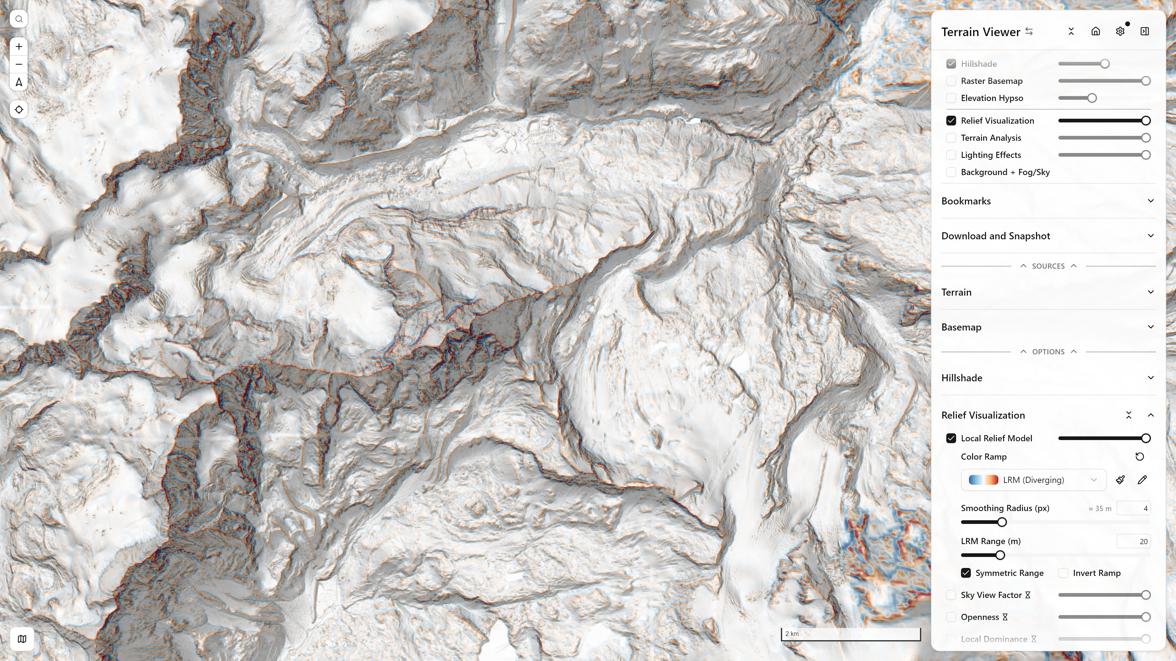
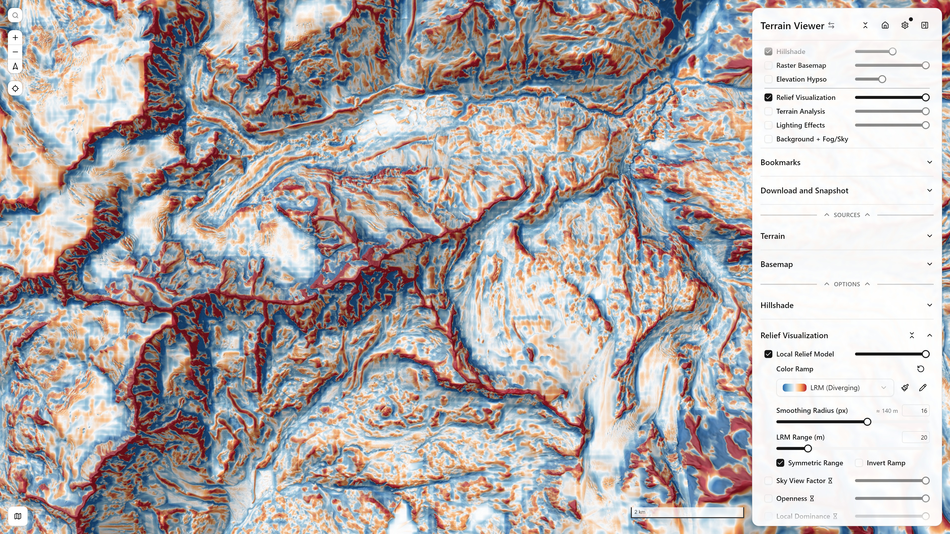
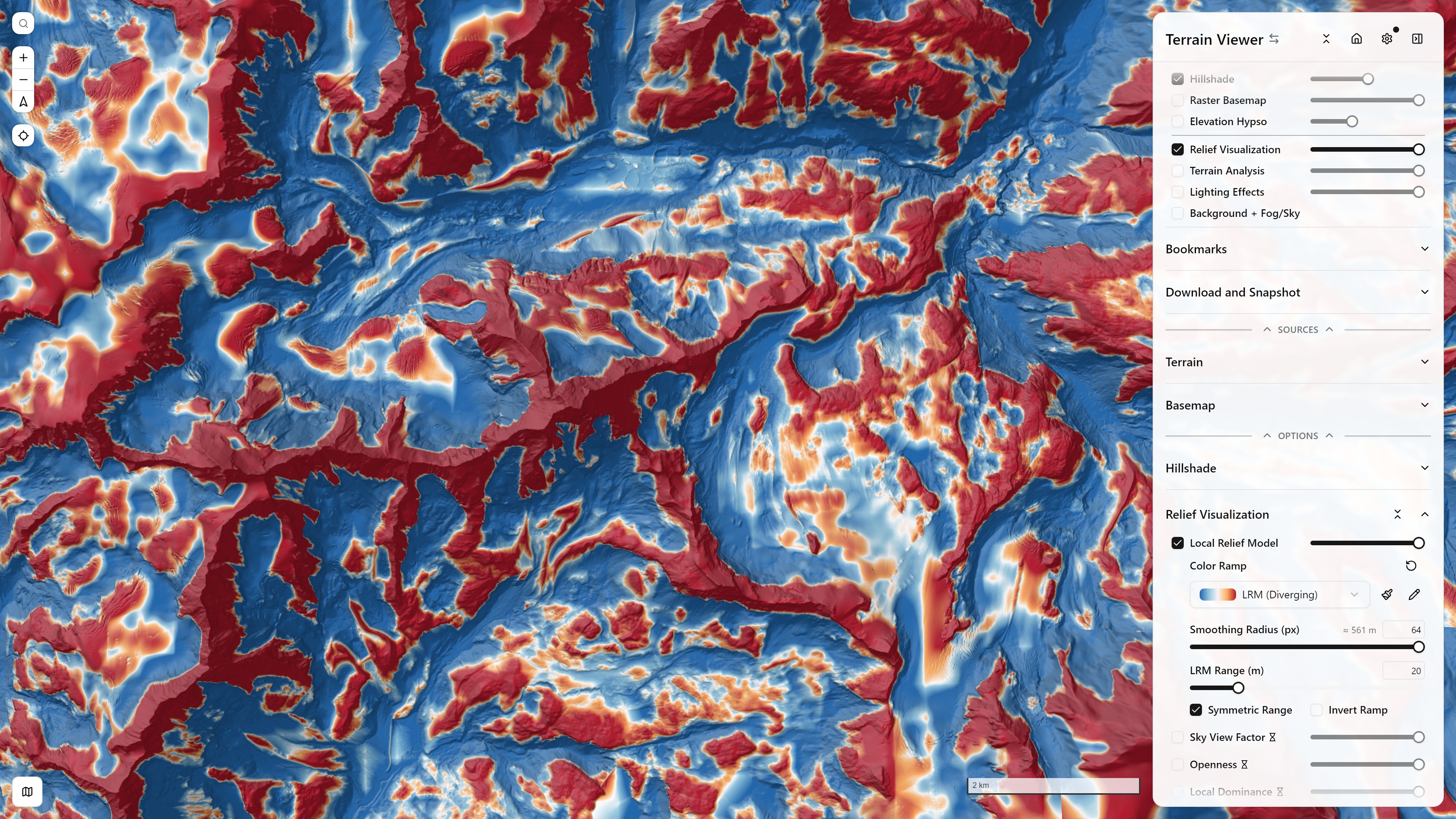
The "Smoothing Radius" slider is a pixel radius, but the app shows a live ≈ N m readout right next to it — the same real-world ground distance radiusMeters = radiusPx * groundResolutionM(lat, zoom, tileSize) computed in lrm-options-section.tsx. Since ground resolution per pixel roughly halves each zoom level in, an unchanged pixel radius covers a smaller and smaller real area as you zoom in — the metric readout is what actually tells you what neighborhood size you're looking at, not the pixel count. Below, radius 4 (barely more than a 3×3 blur) through 64 (a broad regional trend) at the same fixed zoom:
The ancestor-tile trick
An ancestor tile zoom levels up is already a downsampled, low-pass version of the same ground area at coarser resolution — for free, since the tile server (or a COG's baked-in overview level) already did that averaging to produce it. So:
The user-facing "Smoothing Radius" slider maps to k via radiusToLevels():
export function radiusToLevels(radiusPx: number): number {
  return Math.min(6, Math.max(1, Math.round(Math.log2(Math.max(2, radiusPx)))))
}
clamped to [1, 6] — k=1 is barely more than a 3×3 blur, k=6 (~64px radius) is already a broad regional trend for a 256px tile. The ancestor tile's own address is then a simple bit-shift of the fine tile's coordinates: ancestorZ = z - k, ancestorX = x >> k, ancestorY = y >> k (clamped so k never pushes past the world's own root at z=0).
Bilinear resampling, with a half-pixel correction
The ancestor tile is fetched as a padded, 3×3-tile-stitched grid (so sampling near this tile's edges has real neighbor data, not a clamped repeat of the ancestor's own edge) and read back per output pixel via bilinear interpolation:
const ancestorPxY = (yOffsetTiles * n + row + 0.5) / scale - 0.5
const ancestorPxX = (xOffsetTiles * n + col + 0.5) / scale - 0.5
const coarseElevation = bilinearSamplePadded(ancestorGrid, ancestorPxX, ancestorPxY)
const fineElevation = centerTile.data[row * centerTile.width + col]
const lrm = fineElevation - coarseElevation
The +0.5 … -0.5 recentering is deliberate: bilinearSamplePadded indexes pixels by position (ancestor pixel i assumed to sit at coordinate i), but ancestor pixel i is really the box-average of fine pixels [i·scale, (i+1)·scale) — its true center of mass is at fine-position i·scale + scale/2, i.e. ancestor-coordinate i + 0.5, not i. Omitting the correction shifts every sample by up to half an ancestor pixel toward larger x/y (south-east) — negligible at k=1, but up to scale/2 fine pixels at k=6. On steep terrain that reads as a strong, aspect-correlated relief bias rather than genuine local relief: the code comment notes this was confirmed empirically, taking the correlation between LRM and local slope gradient from −0.3…−0.6 down to ~0 once fixed.
The WMS-raw exception
A float32dem-bbox:// upstream (see WMS Float32 DEM Protocol) has no real pre-built overview pyramid — each tile is generated on the fly by a WMS GetMap call for whatever bbox/pixel-size is requested. For the fine tile that's a small bbox at native resolution; for the ancestor, the bbox is scale× larger per side while the app still asks for the same n×n pixels, forcing the server to downsample scale²× worth of data by whatever method it defaults to — often nearest-neighbor. That server-side resampling (not this file's own bilinear math) is what produces visible block edges at large radii on IGN's LidarHD WMS, confirmed absent on Mapterhorn (a real COG/XYZ overview pyramid) at the same radius.
The fix: request the ancestor at a genuinely smaller pixel size instead of trusting the server's downsampling, then bilinear-upsample client-side —
const ancestorRequestSize = Math.max(32, Math.min(n, Math.round((n / scale) * 4)))(×4 oversampled for real neighboring detail, floored at 32px, capped at n so a barely-coarser ancestor just requests full size as before) — the same interpolation a real TMS/COG ancestor already gets from its own pre-filtered overview level, done by hand for a source that has none.
Known limitation
This is the same underlying caveat noted in Terrain Visualization Modes' Tells (Mound Candidate) Detection callout, since Tells layers a Difference-of-Gaussians on top of LRM: COG-streamed sources fetch ancestor (low-pass) tiles with nearest-neighbor resampling at the overview-generation stage — outside this file's control — which can introduce aliasing into the low-pass signal independent of the bilinear-vs-nearest choice made here at read time.
Sharing and output
One ancestor tile backs up to 4^k fine sibling tiles that fall within its footprint — so unlike a same-zoom box blur (which can't share any work between neighboring output tiles), panning around within one ancestor's coverage pays for the coarse fetch only once, via the same sharedTileCache every other derived mode uses.
The final lrm value (fine − coarse, in meters) is re-encoded via elevationToTerrarium exactly like every other terrain-analysis mode (see Terrain Analysis Rendering Pipeline's step 5) and rendered through the "lrm-diverging" color ramp in lib/color-ramps.ts — a diverging ramp centered on zero, the same shape as TPI's, but operating at the pyramid-derived regional scale rather than a fixed 3×3 window.
lib/local-dominance-protocol.ts reuses this exact ancestor-tile trick for its own far-field sampling — one coarse ancestor pixel per octave instead of marching every native pixel — since local dominance's quantity is a mean across many directional samples, and a coarse per-octave sample is a legitimate low-pass proxy for an average. That trick does not carry over to SVF/Openness, whose horizon angle is a max: coarsening the search risks silently skipping past a narrow, nearby obstruction that dominates the true horizon angle — a systematic underestimate, a worse failure mode than local dominance's smoothing bias. See lib/horizon-angle.ts's header comment for the full reasoning.
Possible refinements
Two implementation options, noted on 2026-10-07 and not built:
- Blur the ancestor before subtracting. The trend is a box average on the coarse tile's grid, so its kernel is square and the trend can step at the ancestor's pixel edges once upsampled. A small blur of the ancestor (a few of its pixels, radius about
2^kfine pixels) rounds the kernel and hides the steps, at about 4 ms per tile for a separable box blur, the cost measured for the iso-line's cliff outline. The fetch stays one ancestor per tile. - Height above the local minimum. The same ancestor trick with a minimum instead of a mean: the fine elevation minus the lowest elevation of the ancestor's footprint (or of a ring of its pixels) gives a "height above the local floor", positive with a hard zero, which reads mounds, terraces and tells as heights rather than as a signed residual around a trend. It is close to local dominance, which compares against the mean of a ring. A min filter over the ancestor is cheap; the catch is that a min is not a low-pass, so coarsening the search can miss a narrow pit, the same objection as for SVF.