Feature Overview
A map of what's in the sidebar
The sidebar is organized into a few groups. This page is a map of what each does — see the linked pages for detail.
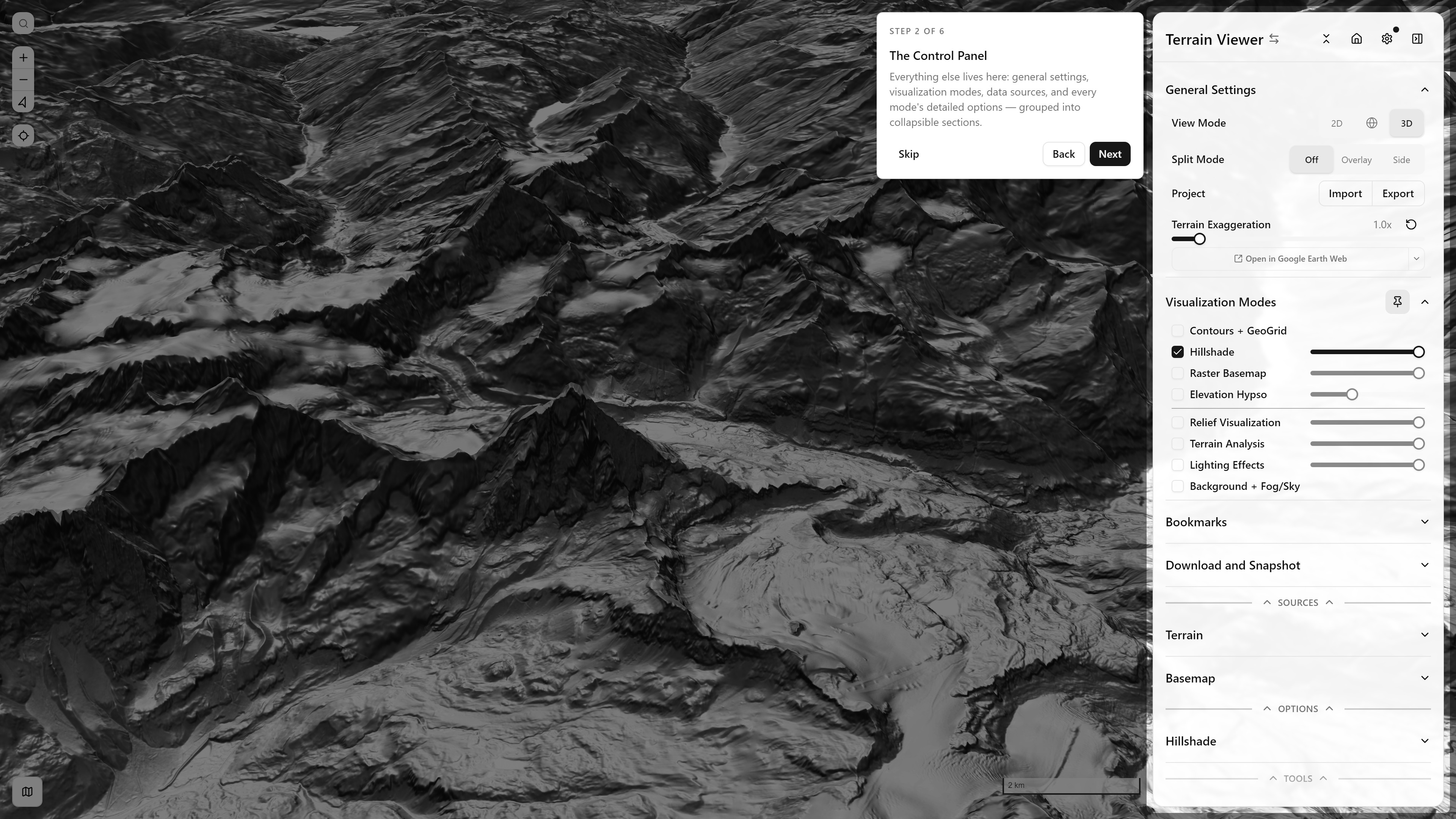
Full sidebar, mid guided-tour — see the Walkthrough (docs screenshots) or take it yourself in-app ↗ (interactive — same as Settings → Take the Tour)
General Settings
- View Mode: 2D, 3D (terrain exaggeration + tilt), or Globe projection. 2D is locked top-down: a right-drag there shows a note with a Switch to 3D button.
- Split Mode (Compare and Blend): Off, Overlay (blended A/B), or Side (independent panes, up to an 8-view grid, in both app modes) — see Split & Compare Modes
- Project: import/export a full app-state JSON, or load a bundled preset via
?project=
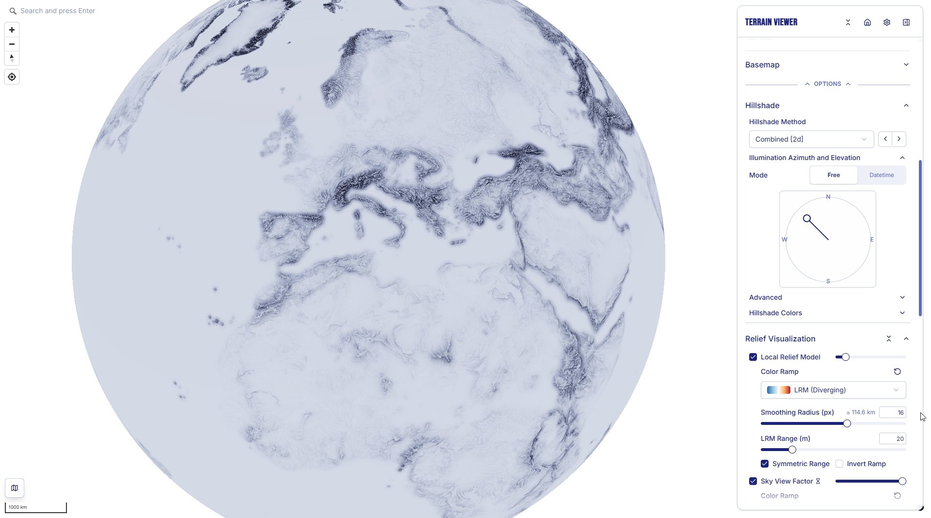
View Mode: Globe — LRM + Sky-View Factor, world view
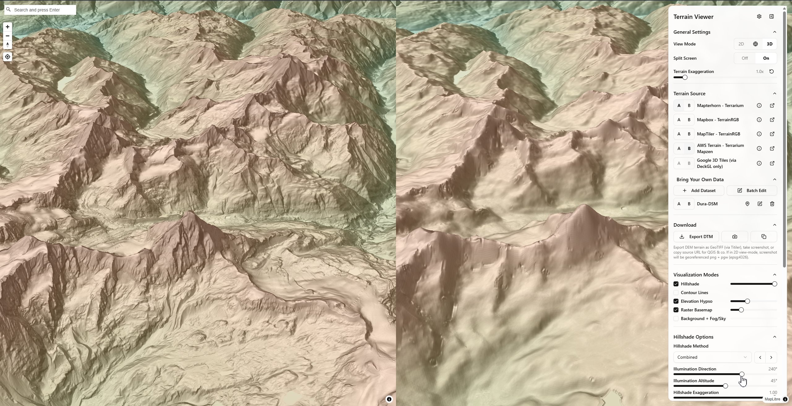
Split Mode: Side — comparing two terrain sources, Combined Hillshade + Elevation Hypso — see Split & Compare Modes
Visualization Modes
Each toggles independently and stacks over the terrain/basemap — see Terrain Visualization Modes for the full list:
- Contours + Geo Grid
- Hillshade
- Raster Basemap
- Elevation Hypso (hypsometric tint)
- Relief Visualization (LRM, Sky-View Factor, Openness, Local Dominance)
- Terrain Analysis (Slope, Aspect, Curvature, TRI, TPI, Roughness, Blobness, Shape Index, Eigen Ratio, Orientation)
- Lighting Effects (Matcap, Phong)
- Background + Fog/Sky
Every mode is also a card in the Data layers picker (the layers button in the sidebar header): one picture per mode, a click turns it on or off, the sections are the sidebar's own. See Data layers picker.
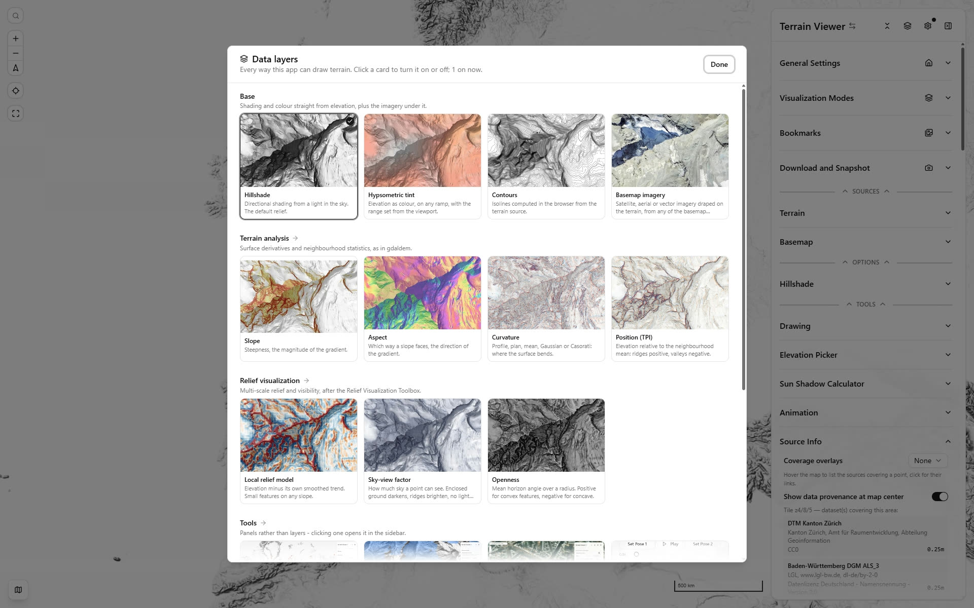
The Data layers picker, one card per mode, with the modes that are on ticked
Bookmarks
Save the current viewport and every visualization setting as a named, thumbnailed bookmark — see Bookmarks.
Sources
- Terrain: Mapterhorn, Mapbox, MapTiler, AWS Elevation Tiles, or a custom Terrarium/Terrain-RGB/COG source — see Bring Your Own Data
- Basemap: satellite/hybrid basemaps, plus the combined Historical Imagery entry (Wayback, HLS, Google Earth Historical, Planet) — see Basemaps and Overlays, Historical Imagery Timeline and Historical Sources
Options & Tools
- Per-mode option panels (e.g. Hillshade method/exaggeration)
- Drawing (TerraDraw-based sketch/measure tools)
- Elevation Picker
- Animation (fly-through/keyframe export)
- Sources Coverage (now under Terrain and Basemap, see Coverage Overlays)
- About, the last section: credits, the build day and commit (linked to GitHub), and Is this the latest version?, which asks GitHub for the newest commit on
main(what the website serves) and for the desktop release, and says whether this build is behind (reload the page to update the website; see Desktop for the bundles)