Basemaps & Historical Imagery
Satellite basemaps and the historical imagery timeline
Basemap sources
The Basemap section under Sources offers several satellite/hybrid basemaps (Google Hybrid, Bing Aerial, ESRI World Imagery, Mapbox Satellite, HERE Satellite, Google Satellite, OpenStreetMap) plus any custom source you've added — see Bring Your Own Data.
In split view (grid layouts up to 4×2 / 8 views, labeled A–H), each basemap row shows an A–H button grid so a different source can be assigned per view. Clicking a row's label (not just its A–H buttons) sets every active view in the current grid layout to that source in one click — handy for putting a whole 4×2 comparison grid onto Historical Imagery without clicking each pane individually.
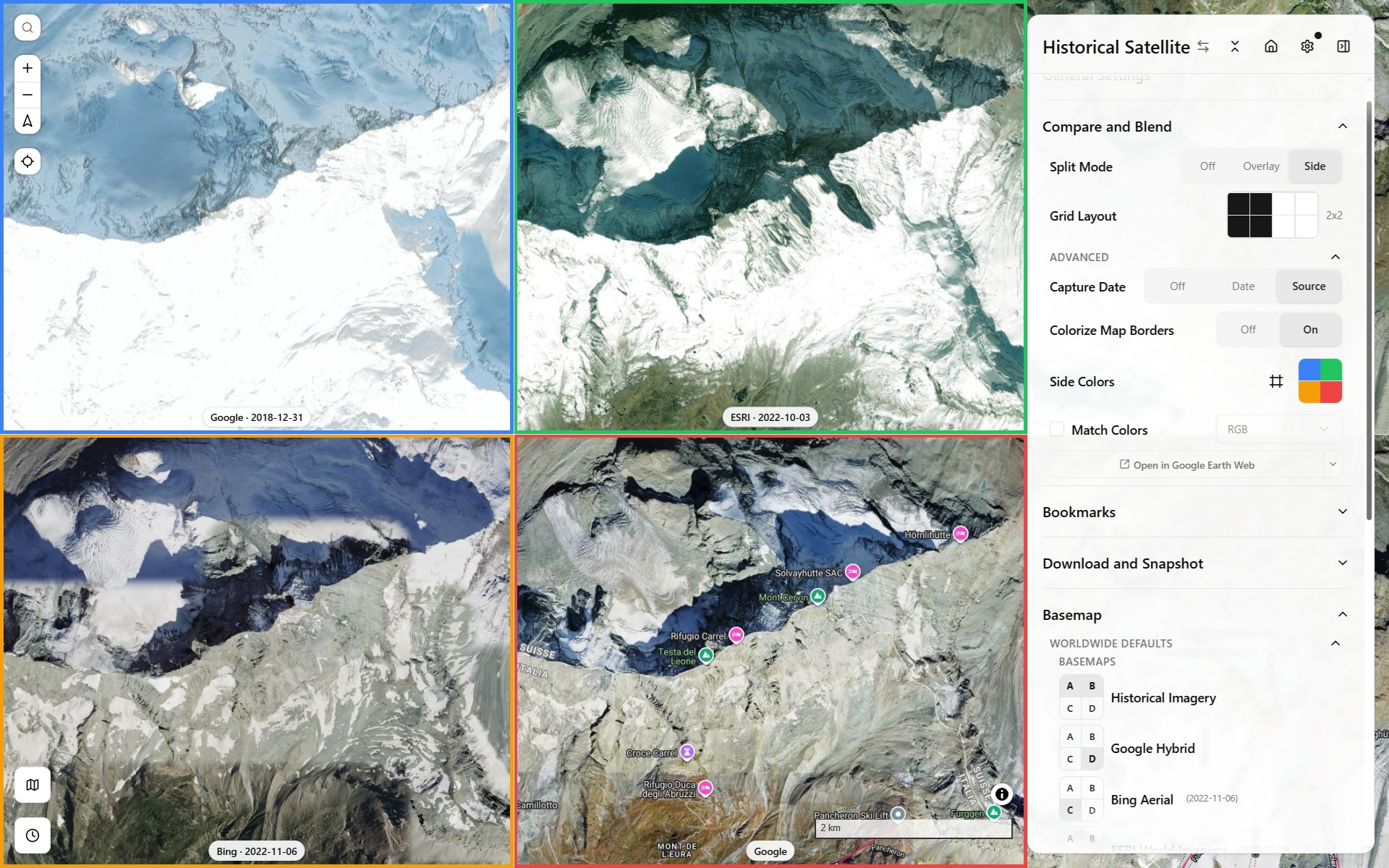
Basemap comparison, Side grid mode
Historical Imagery mode
"Historical Imagery" is a single combined basemap entry covering four underlying providers:
- ESRI Wayback — dated releases of ESRI World Imagery (see the dev page for how this app resolves a date to a release)
- HLS (Harmonized Landsat/Sentinel-2) — monthly, coarser resolution
- Google Earth Historical — occasional very old outlier captures for well-covered areas, via a reverse-engineered
gehist://protocol scaffolded from Iconem's own GE_TimeMachine (see the protocol deep dive for how it actually works) - Planet Monthly Mosaic — requires an API key
Which one actually renders for a given view/date is chosen via the timeline panel at the bottom of the map, not the sidebar. Each provider gets there differently — see the dev pages for the two most involved.
A 4×2 grid mixing three of the four providers across different capture dates over the same spot (Île de la Cité, Paris) makes the resolution/coverage gap between them obvious at a glance:
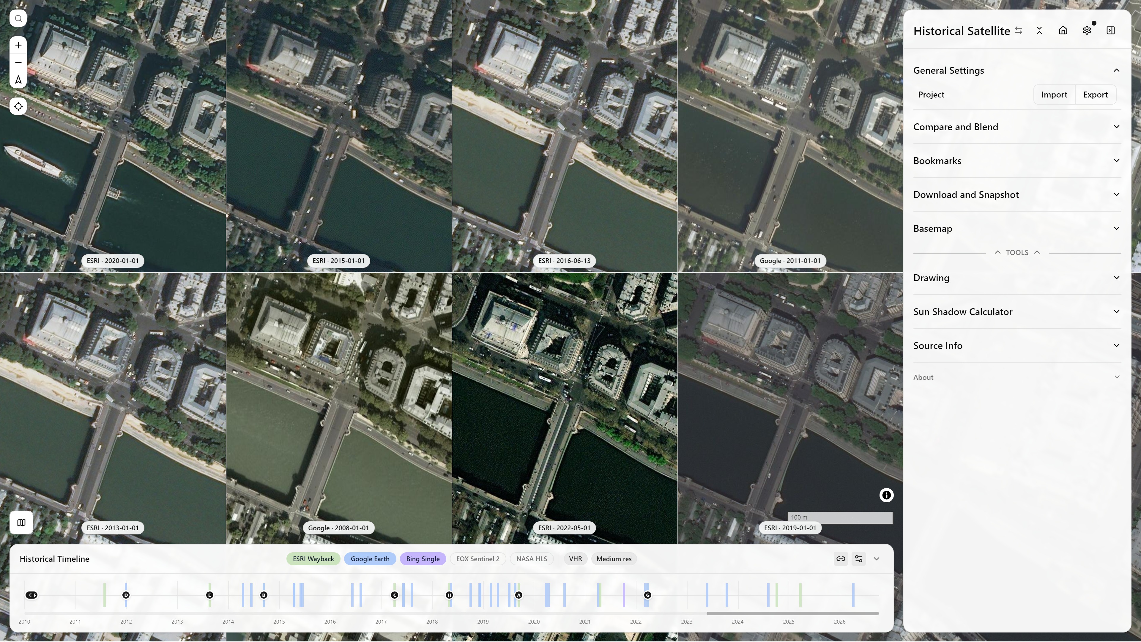
Historical Imagery, Split Mode Side (4×2) — ESRI Wayback and Google Earth Historical mixed across capture dates — Île de la Cité, Paris — see Split & Compare Modes for how the grid itself works
The timeline panel
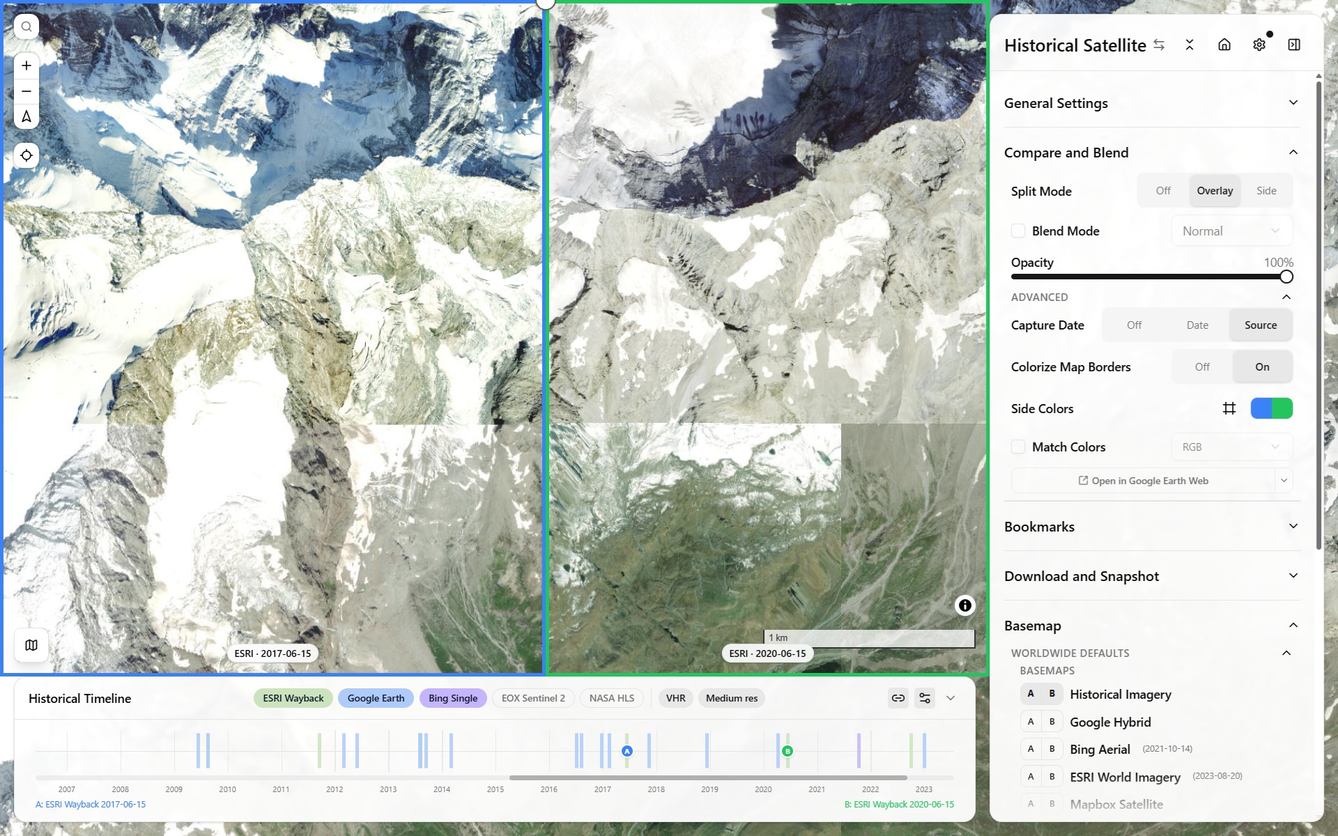
Historical timeline panel — scrubbing capture dates across providers
- Each active view gets a draggable handle on the timeline, positioned at its currently selected capture date.
- Source pills toggle which providers contribute ticks to the shared timeline; resolution-class filters (VHR vs. medium) narrow it further.
- Zoom: mouse wheel zooms the timeline in/out around the cursor; a trackpad two-finger swipe pans. The zoom-out limit extends slightly (10% per side) past the oldest/newest real tick, so those extreme marks always have breathing room instead of sitting flush against the track's edge.
- Pan gutter: when zoomed in, a small gutter below the track shows where the current window sits within the full range — drag it, or click it, to jump.
- An off-screen handle shows a chevron; clicking it nudges the relevant edge of the view window out to reveal it.
Wayback and Google Earth Historical are the two genuinely different architectures behind that timeline (release-chained catalog vs. self-contained-per-tile protocol); HLS and Planet are both simple monthly-mosaic lookups:
Dedicated historical-imagery entry point
The app's appMode (terrain | historical) controls whether the full sidebar or a stripped-down historical-imagery-only sidebar is shown — see the in-app Mode Picker (click the sidebar title). It's a shareable/bookmarkable URL param (?appMode=historical) like every other setting.
Visiting historical-satellite.iconem.com (and any subdomain of it) defaults straight into Historical mode on a first visit, with no query param needed — the main terrain-viewer.iconem.com deploy (or any other/unknown domain, a fork, localhost, a preview URL) keeps the normal Terrain default. Once you've explicitly switched modes in your browser on a given domain, that choice is remembered for next time.